Mapping Wonderlands

232 pages, 7 x 10
69 photos
Hardcover
Release Date:02 May 2013
ISBN:9780816509324

Mapping Wonderlands
Illustrated Cartography of Arizona, 1912–1962
By Dori Griffin
The University of Arizona Press

Though tourism now plays a recognized role in historical research and regional studies, the study of popular touristic images remains sidelined by chronological histories and objective statistics. Further, Arizona remains underexplored as an early twentieth-century tourism destination when compared with nearby California and New Mexico. With the notable exception of the Grand Canyon, little has been written about tourism in the early days of Arizona’s statehood.
Mapping Wonderlands fills part of this gap in existing regional studies by looking at early popular pictorial maps of Arizona. These cartographic representations of the state utilize formal mapmaking conventions to create a place-based state history. They introduce illustrations, unique naming conventions, and written narratives to create carefully visualized landscapes that emphasize the touristic aspects of Arizona.
Analyzing the visual culture of tourism in illuminating detail, this book documents how Arizona came to be identified as an appealing tourism destination. Providing a historically situated analysis, Dori Griffin draws on samples from a comprehensive collection of materials generated to promote tourism during Arizona’s first half-century of statehood. She investigates the relationship between natural and constructed landscapes, visual culture, and narratives of place. Featuring sixty-six examples of these aesthetically appealing maps, the book details how such maps offered tourists and other users a cohesive and storied image of the state. Using historical documentation and rhetorical analysis, this book combines visual design and historical narrative to reveal how early-twentieth-century mapmakers and map users collaborated to imagine Arizona as a tourist’s paradise.
Dori Griffin, a former Arizona Humanities Council Road Scholar, is an assistant professor of art and design at the University of Southern Mississippi.
Acknowledgments
Introduction
1. Writing the Wonderlands of Arizona
2. Contextualizing Arizona’s Cartographic Illustrations, 1912–1962
3. Adopted Identities: Map-makers, Map Users, and Illustrated Roles
4. Rewriting Time: Illustrated Cartography and Arizona’s Temporal Landscape
5. Crowded Spaces: “How We Filled in the Map”
6. Cartographic Narratives of Place: Writing Stories onto Arizona Landscapes
7. Cartographic Narratives of Cultural Exoticism: Stories with Local Color
Conclusion: Rereading Arizona as a Wonderland
Appendix: Popular Cartographers of Arizona, A Biographical Catalogue
Notes
Index
Related Titles
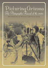
Picturing Arizona
The Photographic Record of the 1930s
Edited by Katherine G. Morrissey and Kirsten Jensen